The National Archives of The Netherlands manages a collection of 300,000 maps and drawings, and 400 atlases and map books. These maps were all created from a particular perspective and for a specific purpose, such as managing the Dutch dune area or building a new road network. Some maps were also used as propaganda tools and to control areas of land.
Based on the themes On the way, Maps and Colonialism and Malleable Netherlands, the National Archives shows the ideas and intentions of clients and map makers in the exhibition On the map. Interviewees talk about historical maps that have a personal meaning for them. As a visitor you can also give your personal meaning to our maps by compiling your own travel journal.
These days, you don’t need to lose your way. Almost everyone carries a map in their phone. You enter your destination and Google shows you the way and tells you how long your journey will take. But travelling using a map was not always a matter of course. In the 17th century, there was no network of roads in the Netherlands. Few people had access to a map. To travel by sea, maps were also essential. Without a map, it was almost impossible to know where you were at sea. The National Archives’ map collection therefore contains many maps that were used to navigate.
The National Archives’ map collection is strongly linked to the colonial history of the Netherlands. Much of the collection was created or collected by the Dutch East India Company (VOC) and the West India Company (WIC). The companies used these maps for navigation, warfare, administration and boundary demarcation. This made them an important tool for capturing, controlling and exploiting colonies and trading people. In the 19th and 20th centuries, the colonies fell directly under the Dutch state, which is why maps from this period are included in the collection.
The National Archives’ map collection contains many maps of the Netherlands, mainly of North and South Holland. That’s why you only see maps of Holland here. A significant factor in this is the battle against water. To protect the land from the sea, dunes were created, improved and maintained. In addition, lakes were drained over the course of time, increasing the available quantity of land behind the dunes. In the 20th century, the influence of the government on the layout of cities and the countryside increased.
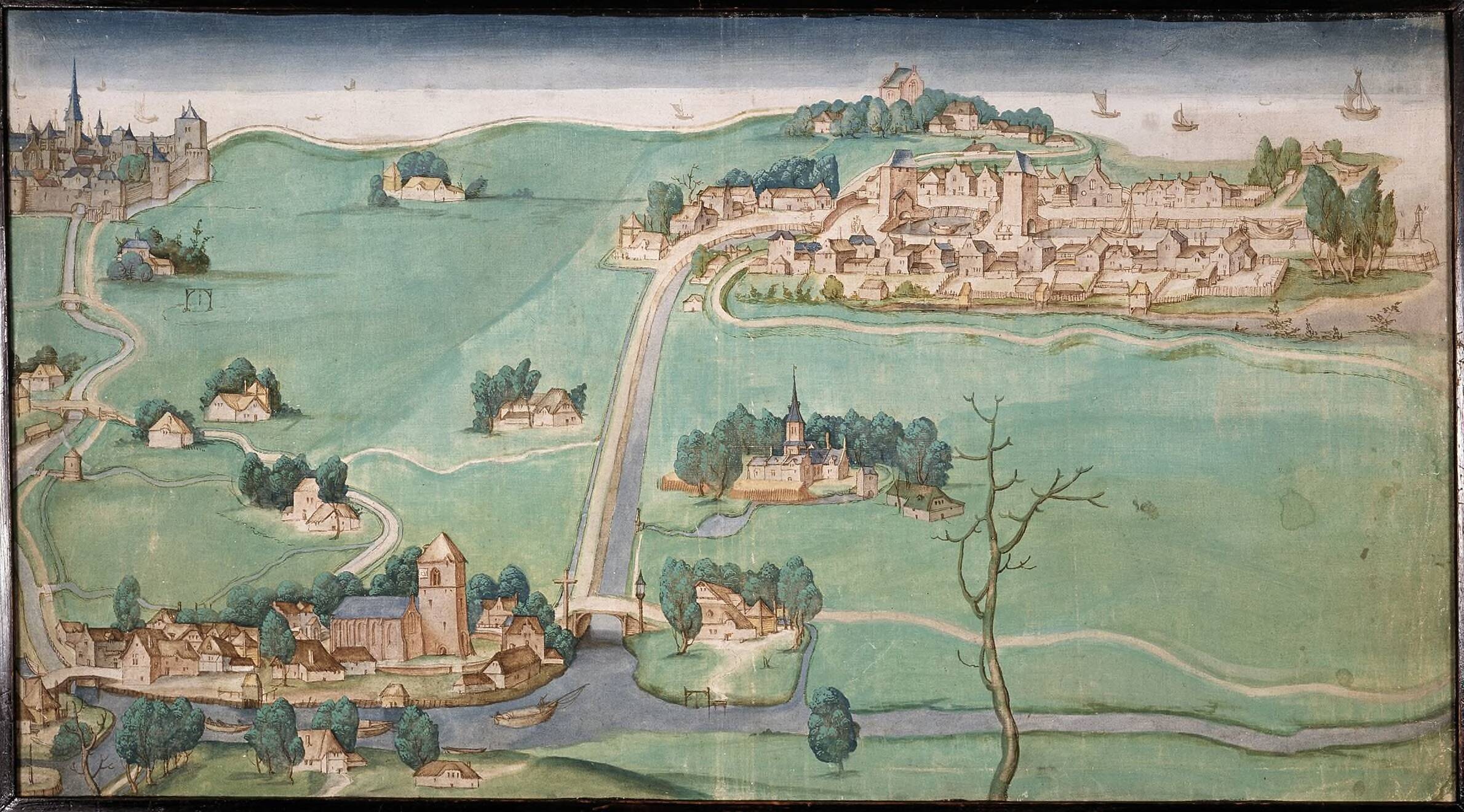
Anonymous, Map of the three Schies between Delfshaven Overschie and Schiebroek on the Schie from Rotterdam and Delft, ca. 1500-1550
Nationaal Archief, Den Haag (The Hague)